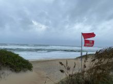
Tropical storms and hurricanes are a fact of life along the East Coast. The East Coast experiences a high number of hurricanes because of the warm waters of the Gulf Stream, which acts as fuel for the storms, and because wind patterns drive them in this direction as they move westward from the tropics. Hurricane season, when the storms are most likely to strike, is from June 1 to November 30.
According to Jay Barnes in North Carolina’s Hurricane History, hurricanes were rarely given names prior to the 1950s. North Carolina and the Outer Banks were hit with several severe hurricanes in the 1800s and early 1900s. In the 1950s, eastern North Carolina earned the moniker “Hurricane Alley” after being repeatedly hit by hurricanes. In one particularly bad year, from October 1954 to September 1955, eastern North Carolina was struck by four destructive hurricanes: Hazel, Connie, Diane and Ione.
Here are just a few of the standout hurricanes the Outer Banks has experienced.
1846 This legendary storm reshaped the Outer Banks. In addition to wrecking homes and ships, the tremendous hurricane caused water to rush from ocean to sound, creating the inlet we now call Hatteras Inlet on the night of September 7. The next day, the storm caused the opening of what is now called Oregon Inlet.
1899 The San Ciriaco Hurricane charted a deadly path through the South and eventually hit Ocracoke and Hatteras islands extremely hard; homes were swept away, ships sank and Diamond Shoals lightship washed ashore. The Hatteras Weather Bureau’s anemometer was blown away, but some readings suggest this storm may have reached Category 5 intensity. The northern Outer Banks also saw flooding and damage in the storm. Seven vessels wrecked off the N.C. coast, and six were lost at sea without a trace. One of the most famous lifesaving missions on the Outer Banks, the wreck of the Priscilla, occurred during this storm when Rasmus Midgett of the Gull Shoal Life-Saving Station singlehandedly saved 10 lives.
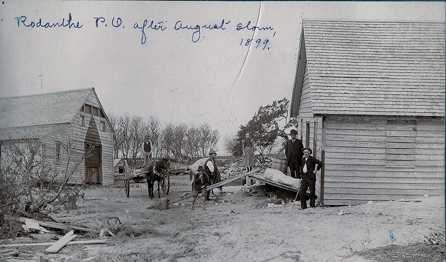
Photo: Rodanthe Post Office after August storm, 1899 - Carol Cronk Cole Collection, OBHC. Courtesy of Outer Banks History Center (OBHC), State Archives of North Carolina.
1933 The Outer Banks was struck by two hurricanes in one season, once on August 22 and again on September 15. The August hurricane, a category 2, passed over the northern Outer Banks and high tides and severe beach erosion were reported all along the islands. September's storm, a category 3, ran up the Pamlico Sound, pushing water into inland communities and killing 21 people. Then the water rushed back to the barrier islands, causing severe flooding and opening Drum Inlet on Core Banks and extreme flooding on Ocracoke Island and communities to the south.
1936 This hurricane remained offshore, taking a path similar to today's Hurricane Erin, with extreme northeast winds wiping out the northern Outer Banks beaches. Hatteras Island residents had severe soundside flooding.
1944 The Great Atlantic Hurricane, a Category 2, caused destruction from Cape Hatteras to Newfoundland. It stayed off the coast but caused significant damage. In Nags Head the storm sank two Coast Guard cutters that were protecting ships from German U-Boats in WWII. Hatteras Island experienced flooding, particularly in Avon. At the time, the Civilian Conservation Corps (CCC) was installing sand fences like formed sand walls along the beach. Massive storm surge from the sound spread across the island, but the sand walls blocked the water from flowing into the ocean, causing the water to pool in Avon. Ninety-six of the village's 115 homes were destroyed or washed off their foundations. In all, the storm claimed 344 lives total in its 900-mile path.
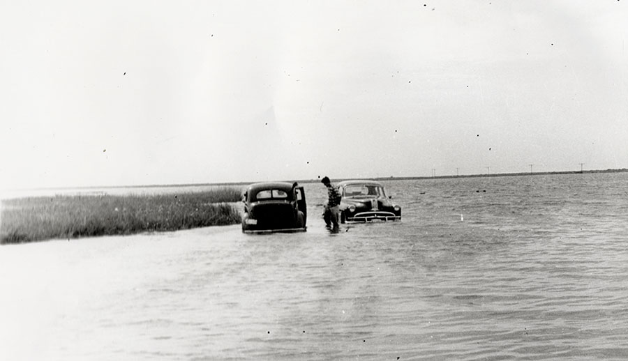
Flooded vehicles in an Outer Banks storm. Courtesy of Outer Banks History Center (OBHC), State Archives of North Carolina, David Stick papers.
1953 to 1959 During this time, North Carolina earned the nickname Hurricane Alley. Hurricane Barbara (1953), Hurricane Carol (1954), Hurricane Edna (1954), Hurricane Hazel (1954), Hurricane Connie (1955), Hurricane Diane (1955), Hurricane Ione (1955), Hurricane Helene (1958) hit the N.C. coast from Wilmington to the northern Outer Banks. The worst by far was Hurricane Hazel, which demolished the state's southern and central coastlines before moving inland and wreaking havoc there.
1960 Category 4 Donna destroyed Florida then set its sights on the N.C. coast. The worst of it was to the south, but Manteo and Nags Head experienced severe flooding and damage on the back side of the storm. Raging floods swept through Kitty Hawk, Kill Devil Hills, Nags Head and Manteo from the sound.
1985 Category 3 Hurricane Gloria made landfall in Hatteras, creating a 6- to 8-foot storm surge in many parts of Dare County. Highway 12 was overwashed in several locations. Downtown Manteo flooded with 4 feet of water.
1993 A major Category 3, Hurricane Emily remained offshore but caused record flooding on Hatteras Island, the worst in more than 30 years. Flooding along the shores of Pamlico Sound on the island was from 8 to 10 feet higher than normal. In all, about 700 buildings were damaged, and about 25 percent of the island’s residents were homeless. Cape Hatteras School was destroyed by flood waters. Six Coast Guard houses were destroyed by a tornado.
1999 First Hurricane Dennis hovered offshore, dropping up to 19 inches of rain on the Outer Banks. Less than two weeks later came Category 2 Hurricane Floyd. The combination of the two storms caused $10 million in damages due to flooding along the Outer Banks and extreme inland flooding. Statewide, there were 35 deaths, 7,000 lost homes and 56,000 damaged homes.
2003 Category 2 Hurricane Isabel wreaked havoc on the Outer Banks. Making landfall at Drum Inlet in Cape Hatteras National Seashore, the storm brought 104 mph winds and 6 to 10 feet of storm surge. The storm created a breach between Frisco and Hatteras village. The temporary inlet, known as Isabel Inlet, cut off power, water and vehicular access to Hatteras village. The storm created major ocean overwash and wiped out piers, highways, beaches and homes, causing $167 million in damages in Dare County.
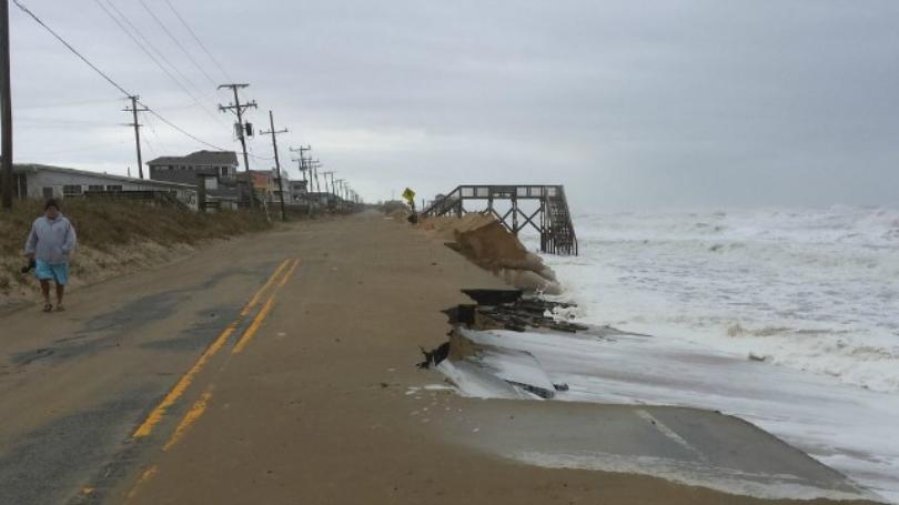
Hurricane damage on N.C. 12 in Kitty Hawk (year unknown).
2011 Hurricane Irene made landfall near Cape Lookout as a Category 1 downgraded from a Category 3. There was hope that downgrade was good news, but it was not to be. Irene caused catastrophic storm surge (10 to 12 feet) from the sound in Avon, Rodanthe, Waves and Salvo. This storm changed the landscape, creating two distinct inlets along Pea Island. Residents of the Tri Villages were unable to return home for 10 days, and Highway 12 was closed from August 27 to October 10. Hatteras residents had to ferry to the island from Stumpy Point to Rodanthe. The Captain Richard Etheridge Bridge on Pea Island was constructed at the site of the new inlet, dubbed Irene’s Inlet or New New Inlet among the locals.
2016 Hurricane Matthew did not directly hit the Outer Banks, but its effects were felt in disastrous flooding on the northern Outer Banks, especially along the beach road in Nags Head.
2019 Category 1 Hurricane Dorian came ashore at Cape Hatteras, causing a 4- to 7-foot storm surge in Hatteras and damaging 1,126 homes from Duck to Hatteras. However, Ocracoke took the brunt of the storm. A 7.4-foot storm surge flooded Ocracoke’s homes, cars, streets and buildings. Thankfully there was no loss of life, but the storm took a major toll on tourism and the islanders’ way of life.
This is just a sampling of the hurricanes that have hit the Outer Banks and only a small description of each. Each storm has wreaked havoc in its own unique way, and everyone affected by a hurricane has a different experience and a different story to tell. If you want to get an Outer Banks local talking, ask them about a hurricane memory. You're sure to hear some fascinating tales.
If you want to know more about Outer Banks hurricanes, ask in the local bookstores about books on Outer Banks history. A couple of my favorites with some dramatic hurricane tales thrown in are Shipwrecks of the Outer Banks: Dramatic Rescues and Fantastic Wrecks in the Graveyard of the Atlantic and Shipwreck Rescues of the Outer Banks: Sensational Wrecks and Heroic Rescues by the United States Life-Saving Service, both by James D. Charlet. Of course, North Carolina's Hurricane History and Fifteen Hurricanes That Changed the Carolinas by Jay Barnes would be required reading as well.
About the Author Molly Harrison
 Molly Harrison is managing editor at OneBoat, publisher of OuterBanksThisWeek.com. She moved to Nags Head in 1994 and since then has made her living writing articles and creating publications about the people, places and culture of the Outer Banks.